Spitzbergen - Arctic Coal Company |
Harbors, Docks, Buildings, Natural Resources, Mines and Mineral Resources |
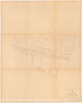
Topographic Map of a Portion of Tract No. 1, Arctic Coal Co. West Spitzbergen [Map land by the shore of around 27,000,000 sq. yards showing survey points, contour lines and a mine and settlement.]
Scanned: May 14, 2008 |
|

Spitzbergen - Arctic Coal Company |
Natural Resources, Mines and Mineral Resources, Geography, Maps, |
Mine No 1 Arctic Coal Co. Longyear City, Spitsbergen. plan of a coal mine.]
Scanned: June 30, 2008 |
|

Spitzbergen - Arctic Coal Company |
Geography, Maps, Natural Resources, Mines and Mineral Resources, |
Sketch Map of NE Portion of Artic Coal Co.'s Tract No.1. Enlarged from G. De Geer's Geological Map of Central Spitsbergen" - 1910 [Blueprint map of lands south of the Advent River showing the boundary of the Arctic Coal Co.'s property and the line of a coal seam in the mountain side.]
Scanned: May 14, 2008 |
|

Spitzbergen - Arctic Coal Company |
Harbors, Docks, Geography, Maps, Natural Resources, Mines and Mineral Resources |
Topographic Map of a Portion of Tract No. 1, Arctic Coal Co. West Spitzbergen [Map land by the shore of around 27,000,000 sq. yards showing survey points, contour lines and a mine and settlement. The original map has been drawn on to show survey areas and coal testing work.]
Scanned: May 14, 2008 |
|

Spitzbergen - Arctic Coal Company |
Natural Resources, Mines and Mineral Resources, Buildings, Geography |
Photograph No. 1. Looking East from Staff-House, showing the position of Mine No. 2. [View of a snowy mountain with a small hut at the bottom, and a zig-zag path up the slope to a small mine above. The roof of a building is visible in the foreground]
Scanned: April 10, 2008 |
|

Spitzbergen - Arctic Coal Company |
Natural Resources, Mines and Mineral Resources, Miners, Geography |
Photograph No. 5. Open-cut before starting permanent Main Entry to Mine No.2. Shows 4 ft. of clean coal at left of face. Ice sheet shows just behind man picking. Ground at right shows pitch into hill. [Two men work on a cut into a hillside. Tools such as picks, drill steels, and a wheel barrow are visible nearby]
Scanned: April 10, 2008 |
|

Spitzbergen - Arctic Coal Company |
Natural Resources, Mines and Mineral Resources, Geography, |
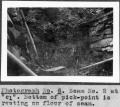
Photograph No. 6. Seam No. 2 at "cl". Bottom of pick-point is resting on floor of seam. [Close-up of a seam of coal. Stone walls frame the seam. A shovel and pick stand by the seam ]
Scanned: April 10, 2008 |
|

Spitzbergen - Arctic Coal Company |
Natural Resources, Mines and Mineral Resources, Geography, |
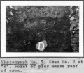
Photograph No. 7. Seam No. 2 at "d". Point of pick marks roof of seam. [A stone labeled "D" rests on a coal seam framed by dry stone walls]
Scanned: April 10, 2008 |
|

Spitzbergen - Arctic Coal Company |
Natural Resources, Mines and Mineral Resources, Geography, Manpower, Labor |
Photograph No. 8. Test-pit on Seam No. 2 at "f". [A man works on the timber roof of a stone walled test pit. One stone of the wall is labeled "F".]
Scanned: April 14, 2008 |
|

Spitzbergen - Arctic Coal Company |
Natural Resources, Mines and Mineral Resources, Manpower, Labor, Geography |
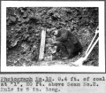
Photograph No.10. 0.4 ft. of coal at "l", 20 ft. above Seam No. 2. Rule is 6 in. long. [A man holds a small ruler in front of a rock face next to a wooden plank labeled "L", a shovel and a pick]
Scanned: April 10, 2008 |
|