
Map of the Copper Range |
Geography, Maps, , |
[Map includes the Section numbers for the various townships located in the copper mining district of the Keweenaw Penninsula.]
Scanned: March 3, 2015 |
|
Topographical Map of the Portage Lake Mining District |
Geography, Maps, , |
Topographic map
Scanned: March 3, 2015 |
|

Cross Sections of the Portage Lake District |
Geography, Maps, , |
Geological Survey of Michigan; Map to Accompany the Cross Sections of the Portage Lake District.
Scanned: March 3, 2015 |
|
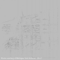
Map of Eagle River Township |
Engineering, Surveying, Geography, Maps, |
Map of Eagle River Township, Lake Superior, Michigan. Surveyed by Schaller (1851), Hulbert & Lum (1855). Recorded in Liber 3 of Deeds, page 82 of Houghton Co. Records
Scanned: April 8, 2015 |
|

Map of the Pewabic Vein |
Metal Trade, Copper Industry and Trade, Copper Mines and Mining, Geography, Maps, |
Longitudinal section along Pewabic Vein from the Pontiac purchase to the shore of Portage Lake. Stoped during December, 1906 in red. Stopes filled in yellow.
Scanned: December 14, 2009 |
|

Map - Isle Royale Copper Company |
Geography, Maps, Metal Trade, Copper Industry and Trade, Copper Mines and Mining, |
Revised Feb. 14, 1918. Map of Entire Surface Isle Royale Copper Company.
Scanned: January 16, 2009 |
|

Composite Map of United States Land Surveyors' Original Plats and Field Notes |
Geography, Maps, , |
Composite map of United States Land Surveyors' Original Plats and Field Notes for the Eastern Section of the U.P. of Michigan Sheet 11
Scanned: February 17, 2011 |
|
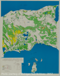
Composite Map of United States Land Surveyors' Original Plats and Field Notes |
Geography, Maps, , |
Composite map of United States Land Surveyors' Original Plats and Field Notes for the Eastern Section of the U.P. of Michigan Sheet 12
Scanned: February 17, 2011 |
|
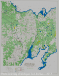
Composite Map of United States Land Surveyors' Original Plats and Field Notes |
Geography, Maps, , |
Composite map of United States Land Surveyors' Original Plats and Field Notes for the Eastern Section of the U.P. of Michigan Sheet 13
Scanned: February 17, 2011 |
|
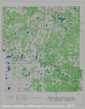
Composite Map of United States Land Surveyors' Original Plats and Field Notes |
Geography, Maps, , |
Composite map of United States Land Surveyors' Original Plats and Field Notes for the Mid-Western Section of the U.P. of Michigan Sheet 15
Scanned: February 17, 2011 |
|