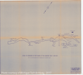
Old Hancock Mine - Workings in Plane of Hancock Fault |
Geography, Maps, Metal Trade, Copper Industry and Trade, Copper Mines and Mining, |
Old Hancock Mine Workings in Plane of Hancock Fault - Peninsula Engineers & Mining Contractors.
Scanned: August 13, 2010 |
|

Geological Profile of Quincy Mine 7 Level Adit |
Geography, Maps, Metal Trade, Copper Industry and Trade, Copper Mines and Mining, |
Geological Profile of Quincy Mine 7 Level Adit M.T.U. Experimental Mine
Scanned: September 29, 2009 |
|

Geological Map of Rockland & Pewabic Townships |
Geography, Maps, , |
Section of a Geological Map of Rockland & Pewabic Townships, Ontonagon County, Michigan
Scanned: July 12, 2010 |
|

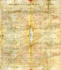
Cloth Map |
Geography, Maps, Water, Lakes, Historic Sites, Historic Districts |
Map of T58N-R29W, Keweenaw Country showing Mosquito Lake to LacLaBelle. [Map is printed on a silk scarf like material that is prone to wrinkling.]
Scanned: May 8, 2013 |
|

Sketch for Relocation of Bandstand |
Geography, Maps, , |
Sketch for Relocation of Bandstand
Scanned: October 4, 2010 |
|

Map of the Quincy Smelting Works |
Engineering, Geography, Maps, Metal Trade, Copper Industry and Trade, Copper Mines and Mining |
Quincy Smelting Works
Scanned: June 2, 2015 |
|

Map of Quincy Smelting Works and Vicinity |
Geography, Maps, Engineering, Metal Trade, Copper Industry and Trade, Copper Mines and Mining |
Quincy Smelting Works and Vicinity
Scanned: June 2, 2015 |
|

Map Keweenaw Park Golf Course |
Geography, Maps, Manners and Customs, Recreation, Sports, Ball Games, Golf, |
Board of County Park Commissioners, Keweenaw County Michigan - Boundary Lines of Golf Course Property in Keweenaw Park - Near Copper Harbor
Scanned: September 13, 2010 |
|

Map Keweenaw Park Golf Course |
Geography, Maps, Manners and Customs, Recreation, Sports, Ball Games, Golf, |
Keweenaw Golf Course - First 9 Holes
Scanned: September 13, 2010 |
|

Map Keweenaw Park Golf Course |
Geography, Maps, Manners and Customs, Recreation, Sports, Ball Games, Golf, |
Keweenaw Golf Course - Contour Map
Scanned: September 13, 2010 |
|