White Pine Copper Company Crusher PlantConveyors |
Natural Resources, Mines and Mineral Resources, Copper Mines and Mining, Historic Sites, Historic Mines, |
White Pine Copper Company, White Pine, Michigan. Crusher Plant - Conveyors 7A and 3A Bottom Slab Concrete Details.
Scanned: July 23, 2014 |
|

White Pine Copper Company Crusher Plant |
Natural Resources, Mines and Mineral Resources, Copper Mines and Mining, Historic Sites, Historic Mines, |
White Pine Copper Company, White Pine, Michigan. Crusher Plant Wall and miscellaneous reinforcing details.
Scanned: July 23, 2014 |
|

White Pine Copper Company Cone Crusher Foundation |
Natural Resources, Mines and Mineral Resources, Copper Mines and Mining, Historic Sites, Historic Mines, |
White Pine Copper Company, White Pine, Michigan. Crusher Plant - Cone Crusher Foundation - Reinforcing Details.
Scanned: July 23, 2014 |
|

Map - Adventure Mine Butler Vein |
Geography, Maps, Metal Trade, Copper Industry and Trade, Copper Mines and Mining, |
Adventure Mine Plan and Section Butler Vein
Scanned: August 25, 2010 |
|

Map Mineral Range Railroad |
Geography, Maps, , |
Map Mineral Range Railroad - Hancock & Calumet Railroad Proposed Tracks to serve the Seneca and Gratiot Mines, Mohawk, Mich.
Scanned: August 10, 2010 |
|

Chart of Portage Lake and River |
Geography, Maps, , |
Chart of Portage lake and River Lake Superior including Torch Lake, Michigan. War Department Corps of Engineers.
Scanned: June 14, 2010 |
|

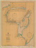
Map of Keweenaw Waterway Michigan including Torch Lake |
Geography, Maps, , |
Keweenaw Waterway Michigan Including Torch Lake
Scanned: June 14, 2010 |
|

Preliminary Chart of Eagle Harbor |
Geography, Maps, , |
Preliminary Chart of Eagle Harbor Lake Superior from surveys under the direction of the Topographical Bureau of the War Department in obedience to Acts of Congress requiring the Survey of the North and North Western Lakes. Surveyed and drawn under the direction of Captain J. N. Macomb Top. Eng. by Lieut. W. F. Raynolds, Top. Eng. Assisted by J. U. Mueller, D. P. Henry and J. Wallace.
Scanned: October 28, 2010 |
|

Preliminary Chart of Eagle River |
Geography, Maps, , |
Preliminary Chart of Eagle River Lake Superior Surveyed and drawn under the direction of Capt. J. N. Macomb T.E. by Lieut. W. F. Raynolds T.E. Assisted by J. Mueller, D. F. Henry and J. Wallace, Civil Assis. in 1855 Published under the supervision of Capt. G. G. Meade T.E. 1859
Scanned: October 28, 2010 |
|

Preliminary Chart of Copper Harbor |
Geography, Maps, , |
Preliminary Chart of Copper Harbor Surveyed by Assistant Henry Gillman 1864. Reduction for engraving by Assistant Joshua Barney 1865. Survey of the N. & N. W. Lakes, Col. W. F. Raynolds, A. D. C. Major Corps of Engrs. Superintendent. Made in obedience to acts of Congress and under the direction of the Bureau of Engineers of the War Department.
Scanned: October 28, 2010 |
|