Spitzbergen |
Natural Resources, Mines and Mineral Resources, Transportation, Geography, Maps |
Fig. 1. Kart som viser Spitsbergens og Bjornoens belliggenhet i forhold til Nord-Europa (English translation - Chart showing Spitsbergen and Bhornoya in relation with North-Europe.) Spitsbergen-Bjornoykullene of Norges Braendselsforsyning. Saertryk av Teknisk Ukeblad nr. 51 1922. S. T. nr. 14. Docent A. Hoel. [A map showing shipping distances from Advent Bay, Spitsbergen, to the major shipping ports of northern Europe]
Scanned: June 24, 2008 |
|

Spitzbergen - Arctic Coal Company |
Natural Resources, Mines and Mineral Resources, Geography, Maps, Engineering, Surveying |
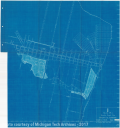
Mine No. 2, Arctic Coal Co. Spitsbergen. Appendix D. 102. 'Arctic Coal Company General Manager's Report Covering Operations during the Year 1912 - 1913' [A blueprint plan of a mine opening]
Scanned: June 24, 2008 |
|

Spitzbergen - Arctic Coal Company |
Geography, Maps, Natural Resources, Mines and Mineral Resources, |
Mine No 1 Arctic Coal Co. Longyear City, Spitsbergen [Plan of a coal mine].
Scanned: June 24, 2008 |
|

Spitzbergen - Arctic Coal Company |
Natural Resources, Mines and Mineral Resources, Manpower, Labor, |
Organization Chart - Winter Season 1914 - 15. Addendum 2. 'Annual Report Covering Year September 1, 1913 to May 31, 1914. Arctic Coal Company. By Scott Turner, Manager' [A blueprint chart of the Arctic Coal Company's organization]
Scanned: June 24, 2008 |
|

Spitzbergen Locations |
Natural Resources, Mines and Mineral Resources, Geography, Maps, Harbors |
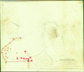
Bell Sound, Recherche Bay. 'Longyear approved APR 14 1913' [A photographic copy of an 1895 map annotated with red x's and a red dashed line]
Scanned: June 24, 2008 |
|

Map of Spitsbergen |
Geography, Maps, , |
Map of Spitsbergen
Scanned: March 3, 2010 |
|

Arcadian Mine Site |
Historic Sites, Historic Mines, , |
[A collage of photos from the Arcadian tourist mine in Ripley. The collage shows 17 photographs, with captions, taken in and around the mine. The original collage was a collection to advertise photos for sale. The text at the bottom of the collage states "Arcadian Mines, Inc - Ripley Adit. All photos made at the Arcadian Adit by Bill Seaman: May 1940, Nov. 1942 and July 1943. Can supply any of these photos enlarged and framed similar to the scenes displayed by the young ladies at right."]
Scanned: February 1, 2006 |
|

Arcadian Mine Site |
Historic Sites, Historic Mines, Buildings, Dwellings, Housing, Single Family, Industries |
[A photo of the Arcadian tourist mine in Ripley. Several industrial structures are on the waterfront and a number of homes are also visible. The caption on the back of the photo states "Taken from the frat house across the lake - 8/20/51."]
Scanned: February 1, 2006 |
|

Arcadian Mine Site |
Historic Sites, Historic Mines, Railroads, Cars, Manners and Customs, Clothing and Dress |
[A photo of the Arcadian tourist mine in Ripley. The image shows a close-up of the adit entrance to the mine. A number of tourists are shown beginning a tour. A small steam locomotive is visible near the entrance to the mine.]
Scanned: February 1, 2006 |
|

Arcadian Mine Site |
Historic Sites, Historic Mines, Human Settlements, Cities and Towns, |
[A color photo of the Arcadian tourist mine in Ripley. The photo was taken from the opposite side of the Portage from the mine. The gift shop is visible, but not much else. The waterfront is in the foreground, and a number of houses are visible.]
Scanned: February 1, 2006 |
|