Quincy Smelting Works |
Geography, Maps, , |
Map of Quincy Smelting Works and Vicinity. Trac. 180
Scanned: December 3, 2009 |
|

Quincy Smelting Works |
Geography, Maps, , |
Map of Quincy Smelting Works Hancock, Mich. Trac No. 426
Scanned: December 3, 2009 |
|

Plan- Stamp Mill No. 2 |
Historic Sites, Manufacturing Process, Mills and Millwork, |
Plan- Stamp Mill No. 2
Scanned: November 26, 2014 |
|

Surface Map, Quincy Mining Company |
Metal Trade, Copper Industry and Trade, Copper Mines and Mining, Buildings, Dwellings, |
Map showing buildings at surface of Quincy Mine [many industrial buildings are numbered and explained in a text block on the map, including shaft houses, boilers, compressors, offices and houses.]
Scanned: September 12, 2008 |
|

Blueprint showing depths of shafts, Quincy Mining Company |
Metal Trade, Copper Industry and Trade, Copper Mines and Mining, Engineering, Surveying, |
Bottom of Shaft [Blueprint chart showing depth of major shafts of the Quincy Mining Company from 1901-1912. Note indicates "stope distances from surface at No. 2 shaft." Includes No. 2, No. 6, No. 7, No. 8, and No. 9 shafts.]
Scanned: March 20, 2008 |
|

Blueprint showing cross section No. 2 shaft, Quincy Mining Company |
Metal Trade, Copper Industry and Trade, Copper Mines and Mining, Engineering, Surveying, |
Cross Section three, No. 2 Shaft [Blueprint map showing side view cross section of the No. 2 shaft of the Quincy Mining Company. Information from Quincy card index indicates the map was originally drawn April 25, 1914, but map was later updated to show increasing depth of the shaft. This version, dated June 16, 1921, shows the shaft going off the edge of the map below the 82 level. Surface features such as the No. 2 shafthouse, Limerick and Hardscrabble locations, and the Quincy powder house, are shown for scale. Also shown are the underground locations of the Allouez conglomerate ore body and the main, east, west and far west portions of the Pewabic ore body.]
Scanned: March 20, 2008 |
|

Underground mine map, Quincy Mining Company |
Metal Trade, Copper Industry and Trade, Copper Mines and Mining, Engineering, Surveying, |
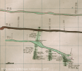
Underground mine map, Quincy Mine [Detail of map showing underground mine workings on levels 73 and 74 near the Quincy no. 2 shaft.]
Scanned: July 3, 2006 |
|

Underground mine map, Quincy Mining Company |
Metal Trade, Copper Industry and Trade, Copper Mines and Mining, Engineering, Surveying, |
Underground mine map, Quincy Mine [Detail of map showing underground mine workings on levels 51 and 52 near the Quincy no. 6 shaft.]
Scanned: July 3, 2006 |
|

Underground mine map, Quincy Mining Company |
Metal Trade, Copper Industry and Trade, Copper Mines and Mining, Engineering, Surveying, |
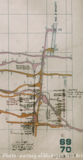
Underground mine map, Quincy Mine [Detail of map showing underground mine workings on levels 69 and 70 near the Quincy no. 2 shaft.]
Scanned: July 3, 2006 |
|

Blueprint of mine tram car, Quincy Mining Company |
Metal Trade, Copper Industry and Trade, Copper Mines and Mining, Engineering, Surveying, |
Mine Tram Car, Quincy Mine [Blueprint engineering drawing showing design for an underground tram car at the Quincy Mining Company. Four views are presented: front end, back end, side view and a plan view showing the wheels / trucks. Note at bottom indicates "Bottom plate 7/16" iron, Sides 3/8" iron, Door 5/16" iron."]
Scanned: March 20, 2008 |
|