Ships - Mackinaw |
Ships, Ice Breaking Vessels, Harbors, Docks, Transportation, Automotive |
U. S. Coast Guard Cutter Mackinaw [View of the vessel at dock.]
Scanned: April 27, 2007 |
|

Dredges |
Excavation, Dredging, Inland Navigation, Canals, Water |
Drg. Col. D. D. Gaillard - 116 x 40 U. S. Engineers in stilling basin entrance to Portage Ship Canal. [Image of the dredge with men standing on the deck.]
Scanned: April 27, 2007 |
|

Tug Boats - Jay C. Morse |
Locomotion, Boats and Boating, Workboats, Tugboats, Harbors, Water |
Tug Jay C. Morse 98 G-Ton. Built 1867 Buffalo. Hebard of Pequaming, owner. Last owned by Ford Motor Company. Abandoned and broken up in 1933 at Range Plant, Dearborn, MI [Image of the tug and another boat with Ford on it's smoke stack.]
Scanned: April 27, 2007 |
|

Shipwrecks - Ralph Budd - Salvage |
Accidents, Marine Accidents, Shipwrecks, Persons, Water |
Bernard Gestel on right and brother at Cat Harbor, Keweenaw County with zinc ingots brought up summer of 1957 from stranded steamer Ralph Budd which ran on rocks, May 6th, 1929. [Image of the two men, one dressed in diving gear, posing with the zinc ingots stamped with "Trademark Anaconda - Made in U.S.A. Electric. Reg. U.S. Pat.]
Scanned: May 1, 2007 |
|

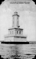
Lighthouse - Portage Entry |
Aids to Navigation, Lighthousers, Water, Lakes, Inland Navigation, Canals |
Lighthouse at Portage Entry near Houghton and Hancock, Michigan [Old postcard type photo of the lighthouse.]
Scanned: May 1, 2007 |
|

Biography - Paul Van Riper, MD |
Persons, , |
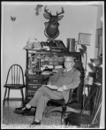
Dr. Van Riper was hired to work in Champion in 1900. He gave the first IV infusions in his career in the UP. He also did dentistry. The mine closed in 1904 and he became a private practice physician. He continued practicing over the ensuing decades, finishing his practice at age 92 and dying one year later. The Van Riper State Park located on US 41was named in his honor. [Image of Dr. Van Riper sitting at his desk.]
Scanned: May 19, 2008 |
|

Cemeteries - Hecla |
Burials, Cemeteries, Geography, Maps, |
Hecla Cemetery [Hand drawn map of Hecla Cemetery showing Hecla Railroad line and Military Road. Includes geographic coordinates.]
Scanned: June 12, 2008 |
|

Calumet and Hecla Mine Location |
Metal Trade, Copper Industry and Trade, Copper Mines and Mining, Buildings, |
Calumet and Hecla Mine Location [Map of the surface workings of the Calumet & Hecla mining company, likely drawn by the company to document its properties. Original is ink on velumm and shows location of mine shafts, other industrial buildings and offices. The map also depicts the greater Calumet area, including the Village of Calumet, Calumet Township, company housing in Red Jacket Shaft, Yellow Jacket and Blue Jacket, Raymbaultown, Swedetown, Albion, Hecla locations. Map does not include addresses or numbers for company houses, and does not include Tamarack Hill, Osceola or Laurium. Map locates churches, schools, roads, and railroad tracks. The original map is colored; likely interpretation is that shaded properties are company owned, with red indicating shaft openings, blue indicating industrial buildings, and grey indicated other company buildings including houses. Some detail images attached here have been converted to grayscale.]
Scanned: August 22, 2007 |
|

Norwich Mine |
Geography, Maps, , |
Norwich Surface Structures. Surface Map from Norwich Annual Report.
Scanned: July 12, 2010 |
|

Norwich Mine |
Geography, Maps, , |
Section of the bluff showing the position of the Norwich vein taken from 1853 Annual Report.
Scanned: July 12, 2010 |
|