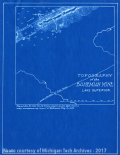
Map of the Topography of the Bohemian Mine |
Historic Sites, Historical Markers, Metal Trade, Copper Industry and Trade, Copper Mines and Mining, |
Topography of the Bohemian Mine in Lake Superior, Traced December 30, 1925 for C. &H. Cons. Copper Co., Geo. Dept., from a map accompanying report of Bohemian Mng. Co., 1852. [Blueprint map shows features such as the Southern Boundary of Trapp Range, Adit level locations and the North and South Veins.]
Scanned: October 31, 2011 |
|

Plan of Bohemian Mine on Dip of Vein |
Historic Sites, Historical Markers, Metal Trade, Copper Industry and Trade, Copper Mines and Mining, |
Bohemian Mine, Northern; Plan of Mine on Dip of Vein; Verticle Section in line of Hoisting Shaft a. Traced December 30, 1925, for C&H Cons Copper Co, Geo Dept, from section accompanying Report of Bohemian Mng Co, 1852.
Scanned: October 31, 2011 |
|

Company Land Holdings of the Keweenaw Peninsula and Western Upper Peninsula |
Engineering, Surveying, Geography, Maps, Metal Trade, Copper Industry and Trade |
Map is included with Calumet and Hecla Mining Co. Abstracts
Scanned: March 24, 2015 |
|

Clifton Mining Company Map |
Historic Sites, Historical Markers, Metal Trade, Copper Industry and Trade, Copper Mines and Mining, |
This document accompanied the Annual Report of 1864. [Blue print maps of Clifton Mine showing the locations of shafts No 4, No 3, No 2 and No 1].
Scanned: October 31, 2011 |
|

Geological and Property Map of Norwich to Derby |
Historic Sites, Historical Markers, Metal Trade, Copper Industry and Trade, Copper Mines and Mining, |
Geological and Property Map of Norwich to Derby; T. 49 N., R.41 W.; traced for C&H Cons Copper Co, Geo Dept, Dec 23, 1925, from map accompany reports of Derby Mng Co, 1864, Cascade Mng Co 1864, Sharon Mng Co 1864, Clifton Mng Co 1864. [Blueprint map shows the geological lay out of the property owned mostly by Clifton Mining Company.]
Scanned: October 31, 2011 |
|

Sketch Map of Columbian Mine and Contiguous Property |
Historic Sites, Historical Markers, Metal Trade, Copper Industry and Trade, Copper Mines and Mining, |
Sketch of Columbian Mine and Contiguous Property accompanying annual report dated April 1862. [Map shows Columbian Mine territory, Portage Mine territory, Isle Royale Mine territory and Sheldon Mine territory in relation to eachother as well as the city of Houghton and Portage Lake.}
Scanned: October 31, 2011 |
|

Conglomerate Mine Openings Map |
Historic Sites, Historical Markers, Metal Trade, Copper Industry and Trade, Copper Mines and Mining, |
Plan on Plane of Belt of Openings in Conglomerate Mine. [Map shows the layout of the underground workings of the Conglomerate Mining Company.]
Scanned: October 31, 2011 |
|

Map of the Copper District |
Historic Sites, Historical Markers, Metal Trade, Copper Industry and Trade, Copper Mines and Mining, |
Map of the Copper District in Michigan showing conglomerate lodes and the property of the Conglomerate Mining Company. [The key shows that the map depicts: conglomerate lodes, amygdaloid lodes, township boundaries, and territorries were companyies own surface rights only.]
Scanned: November 2, 2011 |
|

Transverse Section of the Garden City Mine, Dec., 1860 |
Metal Trade, Copper Industry and Trade, Copper Mines and Mining, Geography, Maps, |
Traced April 30, 1928 for Geological Department, Calumet and Hecla Consolidated Copper Co., from lithograph accompanying Report of Garden City Mining Co. December 10, 1860. Diagram of the Underground Workings on the Ash Bed. John H. Gatiss, Agent.
Scanned: September 8, 2008 |
|

Buildings - Houghton County Courthouse |
Buildings, Public Buildings, Courthouses, Woody Plants, Trees, |
Houghton County Courthouse. [Image of the courthouse when it was surrounded by an iron fence and large trees grew on the grounds.]
Scanned: November 19, 2008 |
|