Mining Accidents |
Persons, Accidents, Miners, Copper Miners |
Accident No. 6. C & H Cons. Mine, January 21, 1930. Michial Medaved came to his death by falling down No. 6 shaft, Hecla Branch of Calumet & Hecla Consolidated Copper Co. The following statement was made by Mine Inspector Matt Ollila after investigating the accident: "Michial Medaved met accidental death in No. 6 shaft of Hecla mine, between the 4th and 5th levels while on an inspection trip. He evidently lost his balance on a slippery sleeper and fell on a descending skip rope that carried him down the shaft to the 15th level. [Account of accident that took Mr. Medaved's life.]
Scanned: November 16, 2010 |
|

Iron Mines |
Metal Trade, Iron Industry and Trade, Iron Mines and Mining, Manpower, Labor, Skilled Labor, Buildings |
Champion Iron Mine - Ishpeming, Michigan [Image showing the mine in operation. A large pile of iron ore pellets can be seen.]
Scanned: August 8, 2006 |
|

Map - Adventure Mine |
Geography, Maps, Metal Trade, Copper Industry and Trade, Copper Mines and Mining, |
Map of Adventure Mine, Greenland, Mich. [Map of the mine showing the section on plane of the Merchant Lode and Knowlton Lode.]
Scanned: June 22, 2009 |
|

Isometric sketch of Calumet conglomerate lode |
Metal Trade, Copper Industry and Trade, Copper Mines and Mining, Engineering, Surveying, |
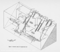
Isometric sketch of Calumet conglomerate lode [Sketch map showing underground workings on the Calumet conglomerate ore body. Sketch shows locations of vertical and incline shafts.]
Scanned: July 5, 2006 |
|

Sketch of open stope in Calumet conglomerate lode |
Metal Trade, Copper Industry and Trade, Copper Mines and Mining, Engineering, Surveying, |
Sketch of open stope in Calumet conglomerate lode [Sketch map showing underground workings on the Calumet conglomerate ore body. Sketch shows relation of shaft, shaft pillar, workig stope and older, caved stope.]
Scanned: July 5, 2006 |
|

Pyramid cut used on Calumet conglomerate lode drifting |
Metal Trade, Copper Industry and Trade, Copper Mines and Mining, Engineering, Surveying, |
Pyramid cut used on Calumet conglomerate lode drifting [Sketch map showing number and direction of shot holes drilled within a typical drift of the underground workings on the Calumet conglomerate ore body. After drilling, these holes would be filled with explosives and fuses which would ignite the charges in the numeric order indicated.]
Scanned: July 5, 2006 |
|

Property Map of the Atlantic Mining Company |
Historic Sites, Historical Markers, Metal Trade, Copper Industry and Trade, |
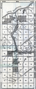
Shaded lands are the prperty of the Atlantic Mining Co. in 1889, from Report of the Atlantic Minnig Company for the Year 1888. [Shows the property of the Atlantic Mining Company amidst a numbered grid system of territories and in relation to Lake Superior, Portage Lake and other water features.]
Scanned: October 26, 2011 |
|

Atlantic Mining Company Location Map |
Historic Sites, Historical Markers, Metal Trade, Copper Industry and Trade, |
Atlantic Mining Company Location, 400 Acres and the new purchas of 200 Acres, from Report of the Atlantic Mining Company for the year 1888. [Map shows some of the mines features that are located along the Atlantic Vein, which runs N 50" 30' E.]
Scanned: October 26, 2011 |
|

Longitudinal Section of the Workings in the Central Mine |
Historic Sites, Historical Markers, Metal Trade, Copper Industry and Trade, |
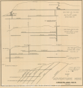
Longitudinal Section of the Workings in the Central Mine, Lake Superior, Michigan, Sec. 23. t.58. R. 31. From the, "Reports of Directors, Superintendent and Treasurer of the Central Mining Company. [Map shows shafts numbers 1 through 4 and the interconnected tunnelings beneath them.]
Scanned: October 28, 2011 |
|

Underground mine map, Forest Mining Company |
Metal Trade, Copper Industry and Trade, Copper Mines and Mining, Engineering, Surveying, |
Section of the Forest Mine, Oct. 1st, 1852 [Map showing underground workings of the Forest Mine near Rockland, Michigan. Credit line at bottom reads "B.W. Thayer & Co. List. Boston." Map shows several shafts, winzes and drifts and includes illustrations of hoisting apparatus. Note is also made of "Indian Diggings" along surface.]
Scanned: July 3, 2006 |
|