Map of White Pine Mine |
Industries, Natural Resources, Mines and Mineral Resources, Copper Mines and Mining, |
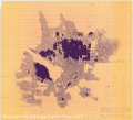
Map of White Pine Mine. [Underground map of White Pine Mine, showing the mining operations of the company by year.]
Scanned: February 25, 2014 |
|

Map - Maintou Island and Gull Rock Michigan |
Geography, Maps, Aids to Navigation, Lighthousers, |
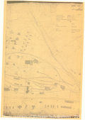
Manitou Island and Gull Rock Michigan Light House reservations. Surveyed and drawn under the direction of Capt. A. Mackenzie, Corps of Engineers, USA by H. A. Ulffers. Traced for Office of Superintendent of Lighthouses by W.L.B. February 26, 1931.
Scanned: October 28, 2010 |
|

Map - Quincy Mine Location |
Geography, Maps, Metal Trade, Copper Industry and Trade, Copper Mines and Mining, |
Map showing some of the features of Quincy Mining Company property, scale= 60 Feet: 1Inch. [This seems to be only a portion of the original map].
Scanned: January 30, 2012 |
|

Map |
Metal Trade, Copper Industry and Trade, Copper Mines and Mining, Buildings, Geography, Maps |
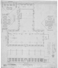
Plan for Drill Shop of the Quincy Mining Company
Scanned: January 27, 2012 |
|

Map- Quincy Blacksmith Shop |
Metal Trade, Copper Industry and Trade, Copper Mines and Mining, Buildings, Geography, Maps |
Plan of Blacksmith Shop as rearranged in 1914 as a part of the Quincy Blacksmith Shop.
Scanned: January 27, 2012 |
|

Map- Quincy Engineer's Office |
Metal Trade, Copper Industry and Trade, Copper Mines and Mining, Buildings, Geography, Maps |
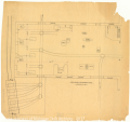
Engineer's Office, Quincy Mining Company; Hancock, Michigan; plan showing arrangement of forges and drill-sharpeners. Scale: 1/8th Inch= 1 Foot. T.C. DeS.
Scanned: January 27, 2012 |
|

Map- Smith for Quincy Mine |
Metal Trade, Copper Industry and Trade, Copper Mines and Mining, Buildings, Geography, Maps |
Plan for the Smithshop of Quincy Mining Company. [Shows both the front and side views of the building.]
Scanned: January 27, 2012 |
|

Isle Royal National Park Map |
Geography, Maps, , |
Map of both natural as well as man made features of Isle Royal National Park by J. J. Black. There is also a small vicinity map that shows better the location of Isle Royal in relation to Canada, Wisconsin and both of Michigan's penninsulas.
Scanned: August 3, 2011 |
|

White Pine Mine General Mine Map |
Geography, Maps, Natural Resources, Mines and Mineral Resources, |
Copper Range Company - White Pine Mine General Map
Scanned: January 22, 2010 |
|

Map - Calumet & Hecla Mills Branch |
Geography, Maps, , |
Calumet & Hecla Mill Branch, Lake Linden, MI.
Scanned: May 6, 2010 |
|