Composite Map of United States Land Surveyors' Original Plats and Field Notes |
Geography, Maps, , |
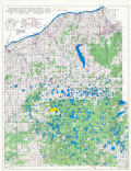
Composite map of United States Land Surveyors' Original Plats and Field Notes for the Western Section of the U.P. of Michigan Sheet 14
Scanned: February 24, 2009 |
|

Composite Map of United States Land Surveyors' Original Plats and Field Notes |
Geography, Maps, , |
Composite map of United States Land Surveyors' Original Plats and Field Notes for the Western Section of the U.P. of Michigan Sheet 16
Scanned: February 24, 2009 |
|

Chart of Lake Superior |
Geography, Maps, , |
Survey of the Northern and Western Lakes made in obedience to Acts of Congress and orders from the Headquarters of the Corps of Engineers, War Department compiled under the direction of Colonel O.M. Poe, Corps of Engineers, Bvt. Brig. Den. U.S.A. from U.S. surveys made between the years 1855 and 1895. The Canadian Shore from British Admiralty Charts and other sources with additions to date under the direction of Lieut.Col. G. J. Lydecker, Corps of Engineers, U.S.A. in 1898 and Major W. L., Fisk, Corps of Engineers, U.S. Army in 1901.
Scanned: April 21, 2010 |
|

General Chart of Lake Superior |
Geography, Maps, Water, Lakes, |
Survey of the Northern and Northwestern Lakes Made in Obedience to Acts of Congress and orders from Headquarters Corps of Engineers, U. S. Army. Compiled under the direction of Colonel O.M. Poe, Corps of Engineers, Bvt. Brig Gen. U.S. Army from U.S. Lake Surveys made between the years 1855 and 1895. With additions and corrections under the direction of Major W. L. Fisk, Corps of Engineers, U.S. Army, in 1901 & 1904. Colonel G. J. Lydecker, Corps of Engineers, U. S. Army, in 1897-8 and 1905-6 and Major Charles Keller, Corps of Engineers, U.S. Army, in 1980-9.
Scanned: November 11, 2010 |
|

Coast Chart No. 4 Lake Superior |
Geography, Maps, , |
Survey of the Northern and Western Lakes made in obedience to Acts of Congress and orders of The Chief of Engineers, U.S. Army Coast Chart No. 4 Lake Superior from Big Bay Point to Ontonagon, Mich. including the Keweenaw Peninsula prepared and first issued under the direction of Colonel G. J. Lydecker, Corps of Engineers, U.S. Army, in 1907. Third edition revised and published under the direction of Lieut. Colonel W. P. Wooten, Corps of Engineers, U.S. Army, in 1920.
Scanned: April 21, 2010 |
|

Coast Chart No. 4 Lake Superior |
Geography, Maps, , |
Survey of the Northern and Western Lakes made in obedience to Acts of Congress and orders from the Headquarters of the Corps of Engineers, U. S. Army. Coast Chart No. 4 Lake Superior from Big Bay Point to Ontonagon, Mich. including the Keweenaw Peninsula prepared under the direction of Lieut. Colonel J. L. Lusk, Corps of Engineers, U.S. Army in 1906 and Colonel G. J. Lydecker, Corps of Engineers, U.S. Army, in 1906-1907.
Scanned: April 21, 2010 |
|

Mass- Michigan Area Map |
Natural Resources, Mines and Mineral Resources, Copper Mines and Mining, Industries, |
Sketch Map of Mass- Michigan Area. Calumet and Hecla Copper Co. -Geological Department. Land Net is from USGS Maps. Surface features are sketched from CRCo Aerial Photos.
Scanned: April 4, 2012 |
|

Map - North American Mining Co. |
Metal Trade, Copper Industry and Trade, Copper Mines and Mining, Geography, Maps, |
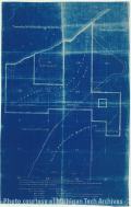
Map showing Pitssburgh and Boston Mining Company, Cliff Mine and North American Mining Co.
Scanned: March 22, 2010 |
|

Map - Cliff Mine |
Metal Trade, Copper Industry and Trade, Copper Mines and Mining, Geography, Maps, |
Map Sec. 2 1-4S Sec. 1 - T.57 N., R. 32 W.
Scanned: March 22, 2010 |
|

Map - North Kearsarge Surface |
Metal Trade, Copper Industry and Trade, Copper Mines and Mining, Geography, Maps, |
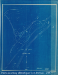
Map of North Kearsarge Surface, Osceola Consolidated Mining Co.
Scanned: August 26, 2009 |
|