Railway Map |
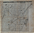
Locomotion, Transportation, Railroads, |
Houghton, Chassell & Southwetern Railroad. Scale 1.5 in - 1 mile.
Scanned: March 7, 2014 |
|

Map - Chassell |
Geography, Maps, Human Settlements, Cities and Towns, Villages, |
Portage Lake Beach - Chassell Bay Beach including the Village of Chassell.
Scanned: December 8, 2008 |
|

Keweenaw Copper Country Lodes and Mining Locations |
Geography, Maps, Metal Trade, Copper Industry and Trade, Copper Mines and Mining, |
The Native Copper Mining Era of The Keweenaw Copper Country Lodes and Mining Locations
Scanned: October 28, 2010 |
|

Map of the Copper Range Railroad |
Transportation, Railroads, Water, Lakes, |
Map of the Copper Range Railroad, Houghton to Range Junction, Houghton to Range Juntion. Scale: 6,000 feet to 1 inch. [Image is an inversed blue print showing how the Copper Range Railroad moves through the different townships of a portion of the Copper Country.]
Scanned: March 2, 2012 |
|

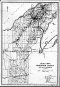
Road Map Houghton County State of Michigan |
Geography, Maps, , |
Road Map Houghton County State of Michigan - Board of County Road Commissioners: M.G. Meyers, C.L. Fichtel - Chairman; J. W. Rice, C. F. Winkler - Engineer
Scanned: July 12, 2010 |
|

Map: Shelden-Columbian Addition |
Geography, Maps, Human Settlements, Cities and Towns, |
Description of Land: The land embraced in this Plat of "Shelden-Columbian Addition, Houghton, Mich.," is a part of Lot 4 and of the North Half of the South-East quarter of Section Thirty-Six, Township Fifty-Five North of Range Thirty-Four West. Dedication: Know all persons by these presents, that we, John H. Rice and Etta N. Rice of Houghton, Houghton County, Michigan, as proprietors, have caused the Land in the annexed Plat to be surveyed, laid out and platted, to be known as "Shelden-Columbian addition, Houghton, Mich.," and that all the streets and alleys as shown on said Plat are hereby dedicated to the use of the public.
Scanned: September 27, 2012 |
|

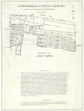
Supervisor's Plat No. 1 of East Houghton |
Geography, Maps, Human Settlements, Cities and Towns, |
Portion of Lot 7, Sec. 31 T. 55 N. R. 33. W. [Plat map showing Portage Lake, College Ave, Florence Street, Vivian Street and Upland Road.]
Scanned: September 27, 2012 |
|

Map: Highland Place Plat Map |
Geography, Maps, Human Settlements, Cities and Towns, |
Highland Place, Jay A. Hubbells and Florence E. Hubbells Addition to the Village of Houghton. [Plat map which includes the streets: Florence, Clark, Hubbell, Blanche, and East.]
Scanned: September 27, 2012 |
|

Supervisors Plat of East Houghton |
Geography, Maps, Human Settlements, Cities and Towns, |
[Plat Map showing East Houghton. Roads shown are, College Avenue, Ruby, Jasper, Houghton, Vivian, Pearl, Emerald and Agate.]
Scanned: September 27, 2012 |
|

Portage Lake Canal Depths |
Manpower, Labor, Skilled Labor, Geography, Maps, |
Copy of map by J.H. Darling, Assistant Engineer, in October and November1890. Under the direction ofMajor James B. Quinn
Scanned: March 3, 2015 |
|